[In February of 2012 I realized I didn’t know much about the local ditch, and so started hunting for it more systematically. Only the pictures are dated.]
When you pass beyond the badlands, the land opens out. You’ve passed the northeast trending boundary between lithosome B from Peñasco and lithosome A from the Santa Fe section of the Sangre de Cristo within the Tesuque formation. Ridges of sediment still exist to the north, but they’re farther back from the road, on the other side of the Rio Chiquito. They’re now Quaternary alluvium.
The road no longer follows the Santa Cruz which lies farther to the right. The WPA Guide to 1930's New Mexico says the area then was "planted with fields of corn, chili, frijoles (Mexican or pinto beans), apple and peach orchards." [1] Today all you can see are houses, many announcing themselves as studios or galleries.
Here and there signs warn of possible water on the road. When you look north, you often see an arroyo that’s been turned into a road.
On the other side of the road you see steeply declining roads where water runs from arroyos and route 76 itself.
Dams were built on several of these washes in 1962, to stop silt from running into the Santa Cruz and the irrigation ditches downstream. In Sabrino’s Map, Don Usner suggests they may have had the unintended consequence of encouraging settlement along the arroyos. He says early settlers in Chimayó "took care to build their homes well away from the arroyo beds" where "spectacular floods once churned," but since the dams were built "random arrangements of mobile homes lay boldly in the path of some of the temporarily constrained washes." [2]
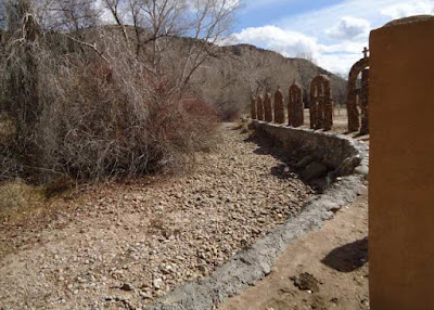
You don’t actually see the Santa Cruz again until you turn towards the Santuario in El Portrero southeast of the old Chimayó plaza. For the most part, the rocks again are smaller than they were downstream.
In front of the dam face, the river is dry or nearly so. The dam is releasing no water right now.
Between the two points, the Rio Quemado has joined the Santa Cruz and snow is continuing to melt from the recent flurries.
End Notes:
1. Work Projects Administration, Federal Writers’ Program. New Mexico: A Guide to the Colorful State. New York: Hastings House, 1940. Reprinted as WPA Guide to 1930’s New Mexico. Tucson: The University of Arizona Press, 1989.
2. Don J. Usner. Sabrino’s Map. Santa Fé: Museum of New Mexico, 1995.
Photographs:
1. Rio Santa Cruz in El Portrero, west of the Santuario on route 520, 16 February 2012.
2. Arroyo to north off route 76 in Chimayó area, 16 February 2012.
3. Road leading off 76 toward Rio Santa Cruz in Chimayó area, 16 February 2012.
4. Rio Santa Cruz in El Portrero, west of the Santuario on route 520, 16 February 2012.
5. Rio Santa Cruz soon after it leaves the dam, off route 520, 16 February 2012.
6. Snow melting into Santa Cruz river from route 503, 14 February 2012.


